Showing posts with label Coastal Flooding Hurricane Sand. Show all posts

Monday, October 29, 2012

What to do after Hurricane Sandy (FEMA)


After a Hurricane FEMA...What to do, guidelines from FEMA


  • Continue listening to a NOAA Weather Radio or the local news for the latest updates.


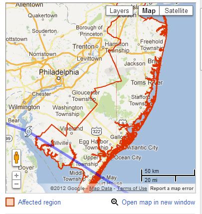
Lobster House Entrance Cape May
Wildwood Flooding


  • Stay alert for extended rainfall and subsequent flooding even after the hurricane or tropical storm has ended.
  • If you have become separated from your family, use your family communications plan or contact FEMA or the American Red Cross.
  • FEMA has established the National Emergency Family Registry and Locator System (NEFRLS), which has been developed to help reunite families who are separated during a disaster. The NEFRLS system will enable displaced individuals the ability to enter personal information into a website database so that they can be located by others during a disaster.
  • The American Red Cross also maintains a database to help you find family. Contact the local American Red Cross chapter where you are staying for information. Do not contact the chapter in the disaster area.
  • If you evacuated, return home only when officials say it is safe.
  • If you cannot return home and have immediate housing needs. Text SHELTER + your ZIP code to 43362 (4FEMA) to find the nearest shelter in your area (example: shelter 12345).
  • For those who have longer-term housing needs, FEMA offers several types of assistance, including services and grants to help people repair their homes and find replacement housing. Apply for assistance or search for information about housing rental resources
  • Drive only if necessary and avoid flooded roads and washed¬ out bridges. Stay off the streets. If you must go out watch for fallen objects; downed electrical wires; and weakened walls, bridges, roads, and sidewalks.
  • Keep away from loose or dangling power lines and report them immediately to the power company.
  • Walk carefully around the outside your home and check for loose power lines, gas leaks and structural damage before entering.
  • Stay out of any building if you smell gas, floodwaters remain around the building or your home was damaged by fire and the authorities have not declared it safe.
  • Inspect your home for damage. Take pictures of damage, both of the building and its contents, for insurance purposes. If you have any doubts about safety, have your residence inspected by a qualified building inspector or structural engineer before entering.
  • Use battery-powered flashlights in the dark. Do NOT use candles. Note: The flashlight should be turned on outside before entering - the battery may produce a spark that could ignite leaking gas, if present.
  • Watch your pets closely and keep them under your direct control. Watch out for wild animals, especially poisonous snakes. Use a stick to poke through debris.
  • Avoid drinking or preparing food with tap water until you are sure it’s not contaminated.
  • Check refrigerated food for spoilage. If in doubt, throw it out.
  • Wear protective clothing and be cautious when cleaning up to avoid injury.
  • Use the telephone only for emergency calls.
  • NEVER use a generator inside homes, garages, crawlspaces, sheds, or similar areas, even when using fans or opening doors and windows for ventilation. Deadly levels of carbon monoxide can quickly build up in these areas and can linger for hours, even after the generator has shut off.

Cape May Hurricane Sandy, Videos from this mornings high tide

Here is a collection of a few Cape May Hurricane Sandy You Tube Videos. Please keep in mind that the tidal surge will be very dangerous this evening. You can follow the tidal surge here at this link.

More than 25,000 now without power in South Jersey


At 12:45 p.m., Atlantic City Electric was reporting 80 outages in its service area affecting more than 25,000 customers.

The areas most affected included the Downbeach towns, Margate, Longport and Ventnor, which had more 14,000 without power, as well as more than 3,100 without power in Atlantic City. In addition, almost 4,000 were without power in the Tuckerton/Little Egg Township area, more than 2,000 in parts of Upper and Dennis townships along Route 9 and more than 1,700 in the Villas section of Lower Township.


Cape May Poverty Beach Flooding

Sunset Beach


Grant street beach. Shot by Chamber President John Cooke @cookecapemay with Iphone4s

Coastal Flood Warning remains in effect until midnight EDT tonight.


Sandy will produce periods of tidal flooding at least into Monday night with some record flooding possible.
Northward moving Sandy will become a powerful Nor`easter As it turns westward on Monday. The storm will come onshore across the New Jersey Coast late Monday evening. Substantial and in some cases record tidal flooding is forecast.

Click here for the Google Public Alert


Coastal Flood Warning remains in effect until midnight EDT tonight.
  • Location: the Atlantic coast of New Jersey and Delaware. Adjacent back bays, Raritan Bay and Delaware Bay.
  • Coastal flooding: Major to spotty record coastal flooding is forecast for this Morning`s high tide, and major to record coastal flooding is forecast for this Evening`s high tide. Along the coast and adjacent back bays, flooding may not completely recede in some locations between the two high tides.
  • At Sandy Hook, New Jersey (Sandy Hook Bay), this Morning`s high tide occurs at 8:01 am, with a forecast Tide level of 9.5 to 10 feet above mean lower low water. This Evening`s high tide occurs at 8:22 pm, with a forecast Tide level of between 11.5 and 13.0 feet above mean lower low water. The latter forecast is a forecast of record tidal flooding. The Forecasts assume that the path of Sandy will cross the New Jersey Coast this evening.
  • At Seaside Heights, New Jersey (oceanfront), this Morning`s high tide occurs at 7:31 am, with a forecast Tide level of around 9.0 feet above mean lower low water. The Monday evening high tide occurs at 7:52 pm, with a forecast Tide level of between 10.0 and 10.5 feet above mean lower low water. The Forecasts assume that the path of Sandy will cross the New Jersey Coast this evening.
  • At Atlantic City, New Jersey (oceanfront), this Morning`s high tide occurs at 7:41 am, with a forecast Tide level of 8.5 to 9.0 feet above mean lower low water. This Evening`s high tide occurs at 8:00 pm, with a forecast Tide level of around 9.5 feet above mean lower low water. The latter forecast is a forecast for record tidal flooding. The Forecasts assume that the path of Sandy will cross the New Jersey Coast this evening.
  • At Cape May, New Jersey (oceanfront), this Morning`s high tide occurs at 8:15 am, with a forecast Tide level of around 9.5 feet above mean lower low water. This Evening`s high tide occurs at 8:34 pm, with a forecast Tide level of 9.5 to 10.0 feet above mean lower low water. The Forecasts assume that the path of Sandy will cross the New Jersey Coast this evening.
  • At breakwater Harbor, Delaware (Delaware Bay), this Morning`s high tide occurs at 8:55 am, with a forecast Tide level of 9.0 to 9.5 feet above mean lower low water. This forecast is a forecast of record or near record flooding. This Evening`s high tide occurs at 9:15 pm, with a forecast Tide level of around 9.5 feet above mean lower low water. This forecast is a forecast of record flooding. The Forecasts assume that the path of Sandy will cross the New Jersey Coast this evening.
  • At Rehoboth Beach, Delaware (oceanfront), this Morning`s high tide occurs at 7:55 am, with a forecast Tide level of around 9.0 feet above mean lower low water. This Evening`s high tide occurs at 8:11 pm, with a forecast Tide level of 9.0 to 9.5 feet above mean lower low water. The Forecasts assume that the path of Sandy will cross the New Jersey Coast this evening.
  • High Tide on the back bays, along Delaware Bay and along Raritan Bay occurs later than the high tide on the Oceanfront.
  • Impacts: numerous roads will flood and need to be closed. Moderate to major property damage is likely with the possibility of severe damage along the coast. The tides and wave action will result in major beach erosion along the coast.
  • High Surf driven by frequent gusts up to hurricane force will contribute to the flooding along the coast.
  • Rainfall: 4 to 10 inches of rainfall is forecast during the period. Heavy rainfall near time of high tide will not drain and will exacerbate tidal floo