Sandy will produce periods of tidal flooding at least into Monday night with some record flooding possible.
Northward moving Sandy will become a powerful Nor`easter As it turns westward on Monday. The storm will come onshore across the New Jersey Coast late Monday evening. Substantial and in some cases record tidal flooding is forecast.
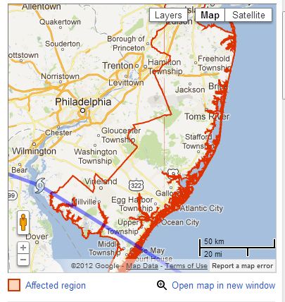
Click here for the Google Public Alert
Coastal Flood Warning remains in effect until midnight EDT tonight.
- Location: the Atlantic coast of New Jersey and Delaware. Adjacent back bays, Raritan Bay and Delaware Bay.
- Coastal flooding: Major to spotty record coastal flooding is forecast for this Morning`s high tide, and major to record coastal flooding is forecast for this Evening`s high tide. Along the coast and adjacent back bays, flooding may not completely recede in some locations between the two high tides.
- At Sandy Hook, New Jersey (Sandy Hook Bay), this Morning`s high tide occurs at 8:01 am, with a forecast Tide level of 9.5 to 10 feet above mean lower low water. This Evening`s high tide occurs at 8:22 pm, with a forecast Tide level of between 11.5 and 13.0 feet above mean lower low water. The latter forecast is a forecast of record tidal flooding. The Forecasts assume that the path of Sandy will cross the New Jersey Coast this evening.
- At Seaside Heights, New Jersey (oceanfront), this Morning`s high tide occurs at 7:31 am, with a forecast Tide level of around 9.0 feet above mean lower low water. The Monday evening high tide occurs at 7:52 pm, with a forecast Tide level of between 10.0 and 10.5 feet above mean lower low water. The Forecasts assume that the path of Sandy will cross the New Jersey Coast this evening.
- At Atlantic City, New Jersey (oceanfront), this Morning`s high tide occurs at 7:41 am, with a forecast Tide level of 8.5 to 9.0 feet above mean lower low water. This Evening`s high tide occurs at 8:00 pm, with a forecast Tide level of around 9.5 feet above mean lower low water. The latter forecast is a forecast for record tidal flooding. The Forecasts assume that the path of Sandy will cross the New Jersey Coast this evening.
- At Cape May, New Jersey (oceanfront), this Morning`s high tide occurs at 8:15 am, with a forecast Tide level of around 9.5 feet above mean lower low water. This Evening`s high tide occurs at 8:34 pm, with a forecast Tide level of 9.5 to 10.0 feet above mean lower low water. The Forecasts assume that the path of Sandy will cross the New Jersey Coast this evening.
- At breakwater Harbor, Delaware (Delaware Bay), this Morning`s high tide occurs at 8:55 am, with a forecast Tide level of 9.0 to 9.5 feet above mean lower low water. This forecast is a forecast of record or near record flooding. This Evening`s high tide occurs at 9:15 pm, with a forecast Tide level of around 9.5 feet above mean lower low water. This forecast is a forecast of record flooding. The Forecasts assume that the path of Sandy will cross the New Jersey Coast this evening.
- At Rehoboth Beach, Delaware (oceanfront), this Morning`s high tide occurs at 7:55 am, with a forecast Tide level of around 9.0 feet above mean lower low water. This Evening`s high tide occurs at 8:11 pm, with a forecast Tide level of 9.0 to 9.5 feet above mean lower low water. The Forecasts assume that the path of Sandy will cross the New Jersey Coast this evening.
- High Tide on the back bays, along Delaware Bay and along Raritan Bay occurs later than the high tide on the Oceanfront.
- Impacts: numerous roads will flood and need to be closed. Moderate to major property damage is likely with the possibility of severe damage along the coast. The tides and wave action will result in major beach erosion along the coast.
- High Surf driven by frequent gusts up to hurricane force will contribute to the flooding along the coast.
- Rainfall: 4 to 10 inches of rainfall is forecast during the period. Heavy rainfall near time of high tide will not drain and will exacerbate tidal floo
No comments:
Post a Comment